Walking the North Downs Way Section 3 & 4: Westhumble to Oxted via Merstham
Right, after all those lockdown shenanigans, let’s finish off this one, shall we? A quick reminder as it’s been a while since I started telling you about my NDW endeavour, the North Downs Way is one of the 16 national trails in the UK. It stretches from Farnham to Dover covering a distance of 153 miles (245 km) in total.
You can either tackle the trail in sections, turn it into a nice day of walking through the British countryside, or cover it in one go if up for a bigger challenge and not opposed to wild camping. I’ve done a bit of both, whereby I’ve already talked and walked you through Section 1 (Farnham to Guildford) and Section 2 (Guildford to Westhumble).
Section 3: Westhumble (Dorking) to Merstham, 10 miles (16 km)

So, moving on to Section 3, we have quite a few challenges coming our way, all good ones though, if you keep that glorious sense of achievement in mind that shall fullfil you once we’ve overcome them! But seriously, it’s not that bad and some are optional.
First one, we’ll be covering two sections in one go this time since Section 3 and 4 add up to 18 miles (28.8 km) ‘only’, so easily doable if you don’t start too late in the day, and don’t mind getting that heart rate up from the start as challenge number two awaits you right then and there in the form of the dreaded Box Hill which I mentioned in the previous post.
As I said, some challenges are optional. If you want to take your time with the hill and stop at its viewpoint for a bit longer to catch your breath and maybe pay the café up top a little visit, which sells excellent ice cream by the way, feel free to split up the sections in two shorter days.
When I did it back in September 2019, it was part of my National Three Peaks and Everest Base Camp preparation, so I properly wanted to break in my boots and see how far my feet would carry me. More importantly, I was also curious how I would feel the day after as I’d have to do that multiple times in future adventures, all through the night even in the case of the Peaks, a hell of a challenge but good fun, once it was done — that sense of achievement definitely made up for a lot of cursing along the way.
Based on that, I have no doubt you can easily tackle two in one as well, especially if you channel your inner George Etzweiler. Before I scare you off completely though, shall we just get going?

After hopping your way over the River Mole via the infamous Stepping Stones, the lowest point along this section, 275 steps await your little legs to offer some support for the longest and steepest ascent of the entire North Downs Way.
If not too keen on the Stones, they can be bypassed, just followed the sign to your left which leads you to a bridge and then quickly brings you back on track. It does not bypass Box Hill I’m afraid but still worth noting since the Stones and Hill are rather popular, especially on sunny weekends, so you might have to wait for a little while before you get to continue your journey and tackle the beast.
When you do, curse away as much as you like, the people coming down will understand having been there before often uttering encouraging words which you might hate in the moment but will deeply appreciate afterwards. And don’t be perturbed by occasional runners passing by with tiny backpacks and gazelle-like strides making you feel like a sweaty mess not having any business being out there. Box Hill is popular amongst trail runners training for all kinds of challenges and charity events, as well as cyclists coming to life on Zig Zag Road which does exactly that. Its series of hairpin bends was even featured on the 2012 Olympic Games cycle road races.
With that in mind, let them whiz by and confidently stick to your own pace which shall get you up and all the way to the end — after all, this is just the beginning, a warm-up so to speak, no need to go all out, still plenty of walking ahead of us, as well as some beautiful views worth taking in rather than rushing by.

Having mentioned charity event enthusiasts, I did actually meet a lovely lady along the way who was training for one herself, the ‘Marbella 4-Days Walking’ event in Spain if I remember correctly. She wanted to participate in memory of a dear friend, another heart-breaking story she shared with me as we happened to follow the same route for a while, wherefore my pictures of the day are a bit more sporadic than usual.
It was a welcome distraction though. It’s amazing what kind of people you sometimes meet when out walking, leading to random conversations that can inspire, trigger certain thought-processes, or simply sharing a moment, a view, an experience along your very own journey. Our ways parted eventually as her usual training route led her in a different direction. Quite a shame really, as I would have loved to share my second favourite spot along the NDW with her, my favourite one in Surrey.
Let me introduce you to Colley Hill, a place that will make you pause for a moment, especially after walking through shaded woodlands for quite a while after leaving Box Hill. The sheer vastness of the area along with the magnificent view of Reigate slowly opening up in front of you as you walk along the ridge, will lift your spirits and weirdly take some weight of your shoulder which you might have been carrying until then — emotionally but also physically, as I would highly recommend this area for a little refuel stop.

In addition to the view, there’s also a little memorial to inspect called ‘Inglis Folley’ which was donated to the Borough of Reigate in 1909 by Lieutenant Colonel Sir Robert William Inglis. Originally a drinking fountain, it now houses a topography and has the night sky depicted on the ceiling. While the structure is perfectly placed for gorgeous panoramic shots, it also offers some shady seats if needed, whereby you might want to watch your step as you’ll be competing with some furry creatures grazing those grounds — another reason why I love this area so much, country girl through and through.

Once you had your fair share of fresh country breeze, soaked up some sun and embraced the views, time to move on to Reigate Hill, which features Junction 8, a café with a rather unique offer if you want to restock on those snacks, fancy a smoothie for a change, or could do with a little toilet stop.
Reigate Hill is a lovely spot itself, even if less peaceful being right next to the road. It’s perfect for a day trip though if not quite sold on the linear hikes yet. And now knowing that quaint Colley Hill is just a short walk away, might be worth parking your car at Reigate Hill for a little change of scenery and a countryside stroll.

When you do, you’ll also pass by Reigate Fort, which is one of 13 military depots built along the North Downs towards the end of the 19th century as a supply line for defences against the French. The feared invasion never came, but you can inspect several of its buildings and information panels today offering a proper day out if a friend of local history.
If you have taken on the double-section challenge, there might not be enough time. So, let’s move on swiftly to Merstham, the beginning of Section 4 which will lead us all the way to Oxted, the last Surrey town before slowly making our way into Kent.
Section 4: Merstham to Oxted, 8 miles (12.8 km)
I might have rushed this section a little bit having lost some time with my Box Hill hiking companion and getting carried away at Colley Hill, so less tales to tell for this 8-mile stretch. There are still two sights I’d like to highlight though which you might want to take in for a bit longer when there.
First, you’ll pass by White Hill Tower once you climbed up the ridge, passed through Merstham, and crossed some high farmland. The latter provides the clue to the towers existence as it was built by a local farmer in 1862 as memorial to his son who died at sea.
The second sight to mention, Caterham Viewpoint, will give you time to ponder about such tragedy and the state of the tower itself. Much enjoyed by the people of Caterham, after which the viewpoint is named, it offers yet another view to admire and is rather inviting for another refreshment stop to give your feet a little break before tackling the final stretch.


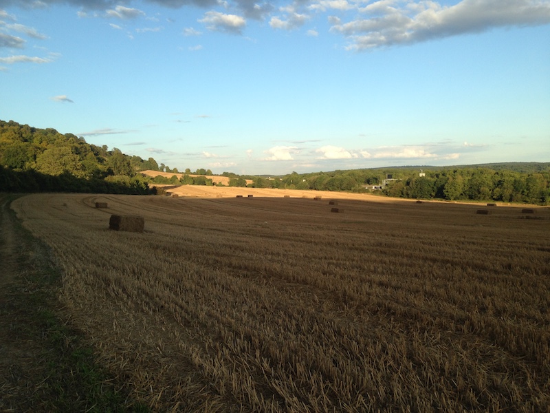
If you opted for two sections in one day, the sun will probably slowly start setting behind you at this point, evening rays illuminating the fields as you make your way to Oxted where today’s section(s) finish — at a gap in a hedge on Chalk Pit Lane to be precise. Sounds odd at first but will make perfect sense when you get there.
Heading down Chalk Pit Lane will lead you straight to Oxted Station whereby the road is fairly narrow at first, so do watch out for cars passing by. After a few hundred metres, you’ll reach a footpath next to the road which you can use for the remainder of the 20-minute walk down to the station. And this brings us to the end.
Four sections done, 11 more to go. Oxted to Otford next — the last day walk before giving wild camping a go!
PS: Due to the slightly anticlimactic finish today and the fact that we’ll be entering Kentish territory next time, here something to ponder about until then: What might be the difference between a Man of Kent and a Kentish Man? 🤔
When was I there? 1 September 2019

Section 5:
11.8 miles (18.9 km)

Section 4:
8 miles (12.8 km)
Section 3:
10 miles (16 km)

Section 2:
13 miles (21 km)

Section 1:
11 miles (17.7 km)